Flashback on Presidential Traverse
Reaching the End of the Trail
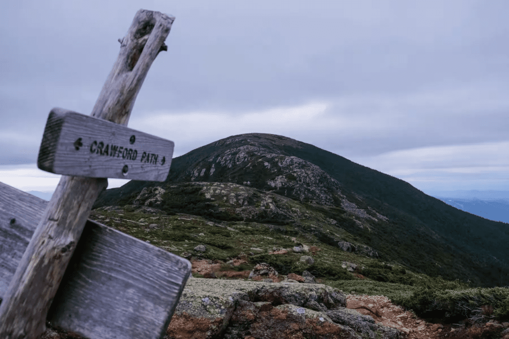
On September 3, 2018, at 11:10 AM, Tom and I emerged from the trees at the trail end of our Presidential Traverse. We paused for a quick look at the brown wooden sign marking Crawford Path, the oldest hiking trail in the United States.

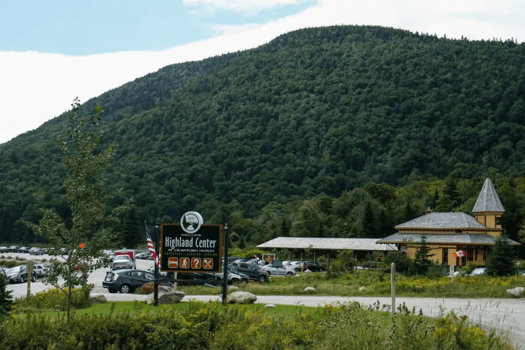
It was Saturday, the first day of Labor Day weekend, and Highway 302 was lined with cars parked bumper to bumper. Across the road, nestled beneath the mountain, stood the light green building of our destination—the Highland Center.
Crawford Visitor Center: A Welcome Rest Stop
The Crawford Visitor Center, a bright yellow wooden cabin, provided a much-needed respite. The center served hikers and tourists, offering maps, souvenirs, snacks, and restrooms with showers. A hot shower after our long hike was a much-appreciated luxury!
After relaxing in the sun for a bit, we made our way to the nearby Highland Center, feeling refreshed and ready for the next steps of our journey.
A Hearty Meal Before the Shuttle
We had booked a shuttle bus online to take us back to the trailhead where our hike began the day before. It was scheduled to depart from the Highland Center at 1:25 PM. The staff kindly directed us to the pick-up spot at the back door and suggested we grab a bite to eat since the restaurant was still open.
Realizing we were hungry, we eagerly checked the menu on the chalkboard. I had skipped breakfast at the Lakes of Clouds Hut earlier, despite it being a hearty spread. To mark our journey, Tom ordered the Turkey Traverse Sandwich, while I chose the Madison Panini, named after Madison Peak. It was a delicious way to commemorate our one-and-a-half-day trek across the Presidential Range.
The Shuttle Back to Appalachia
An hour later, the shuttle bus arrived and dropped us off at the Appalachia trailhead parking lot along Route 2. Along with us, there was another couple who had also completed the Presidential Traverse—they had started a day earlier—and a few younger groups just gearing up for their own adventures.
What is Presidential Traverse
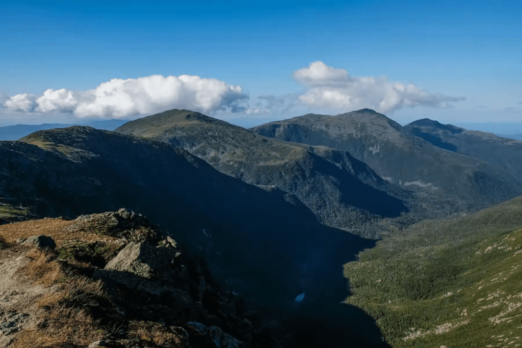
The Presidential Traverse covers a series of nine peaks in New Hampshire’s White Mountains, all over 4,000 feet. Each peak is named after a U.S. president, from north to south: Madison Peak, Adams Peak, Jefferson Peak, Clay Peak (optional), Washington Peak, Monroe Peak, Franklin Peak, Eisenhower Peak, and Pierce Peak.
Here are the essential peaks of the journey:
- Mt. Madison (5367′, 1636 m)
- Mt. Adams (5774′, 1760 m)
- Mt. Jefferson (5712′, 1741 m)
- Mt. Washington (6288′, 1917 m)
- Mt. Monroe (5372′, 1637 m)
- Mt. Eisenhower (4780′, 1457 m)
- Mt. Pierce (4310′, 1314 m)
Optional Peaks (Non-Presidential Names or Those Considered Not Independent by AMC):
- Mt. Clay (5533’, 1686 m)
- Mt. Jackson (named after a geographer) (4052’, 1235 m)
- Mt. Webster (3911’, 1192 m)
- Mt. Franklin (although it meets the 4000ft mark, it’s only 50 feet higher than the trail) (5003’, 1525 m)
Jackson is a rarely visited peak, mostly because the route isn’t convenient and requires a stretch of road walking before returning to Highland Center.
The distance and elevation gain vary slightly depending on the route you choose. My watch recorded a total of 35 kilometers with 3737 meters of elevation gain. We hiked over the course of one and a half days (staying overnight in the mountains), and with our drive from Toronto, we managed to complete it in three days.
We left Toronto on Thursday morning and arrived in Gorham, New Hampshire that evening (a 9-hour drive). Gorham is the closest town to the start of the Presidential Traverse, just 7 kilometers away. It has several motels and restaurants, with McDonald’s opening as early as 5 AM. Gorham is also a stop on the Appalachian Trail (AT), so you might spot thru-hikers with big packs passing through.
Our Presidential Traverse Route
The Presidential Traverse is typically done from north to south, starting at Appalachia—just a parking lot with no restrooms, free of charge. The finish line is at Highland Center, where you’ll find both food and accommodations. Most people take two to three days to complete it, but some hardcore hikers do it in just one day.
For planning, I mostly referred to an article on sectionhiker.com, which provided helpful information on the route, accommodations, shuttles, and weather. You can also use phone apps like Hiking Project and AllTrails while hiking for real-time reference. When we were last in the White Mountains, we picked up a waterproof map at Pinkham Center. There are several types of maps for the area, and we selected one that was specific to the Presidential Traverse.
Packing for the Hike
On Friday morning, after a quick breakfast at McDonald’s, we returned to our room to pack our bags for the mountain. Since we were staying overnight at Lake of the Clouds Hut, we packed what we would need for the hike, including water (two bottles per person), a water filter (which we didn’t use), energy bars, sunscreen (as you spend a long time above tree line), toiletries, a headlamp (since the huts don’t have lights), spare underwear, base layers, extra socks, and slippers.
We didn’t need hats, gloves, or mid-layers this time because the weather was so perfect. We also made sure to bring enough short-sleeve t-shirts, as we were sweating quite a bit. The hut provided three wool blankets and pillows (although we were pleasantly surprised by clean pillowcases). Tom brought his own lightweight sleeping bag, and I brought a thin double sheet and pillowcase.
Day One: Conquering the Peaks of Presidential Traverse
Mount Madison
8:00 AM
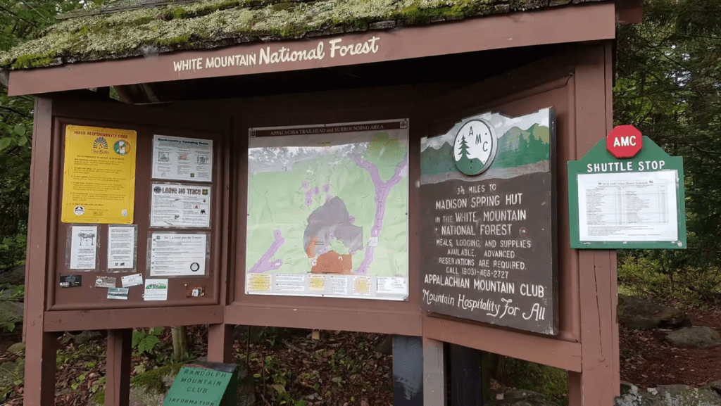
Trailhead: Appalachia.
We set off early, and by the time we arrived, only about four or five parking spots remained. We began our hike up Valley Way, which later turned out to be the easiest stretch of the entire trail.
Around 10:30 AM, we emerged from the tree line and reached Madison Spring Hut. We dropped off our packs, took just a camera and a bottle of water, and headed up Mount Madison. Though Madison is the fourth-highest peak in the White Mountains, it’s a bit shorter than Monroe Peak by a few meters.
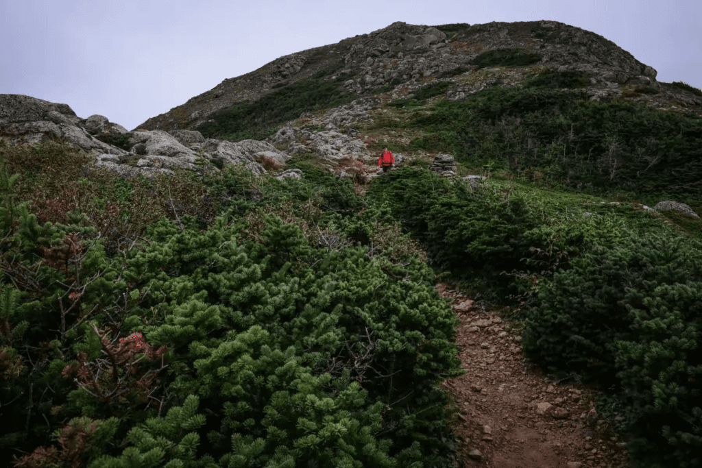
We climbed along Osgood Trail, covering nearly 1 mile back and forth. The rocks were mostly chest-high, and I had to use both my hands and feet to climb over them. Tom, however, was having a blast and managed to “parkour” over the rocks—so much so that I even recorded a clip of him.


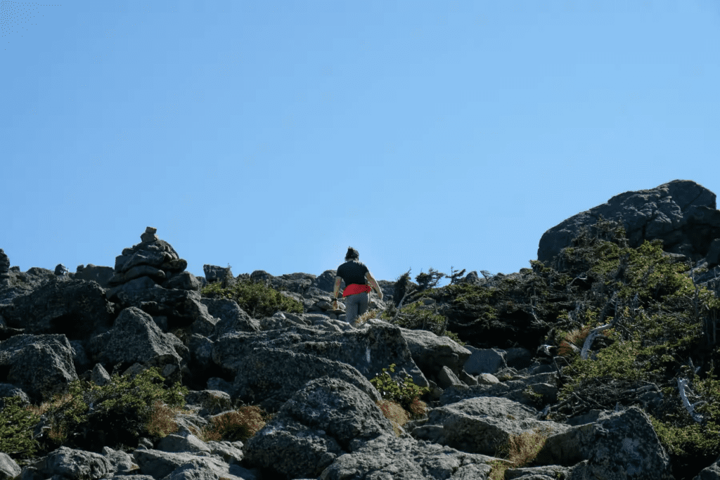
At the summit, we met a couple of older women with large packs who were taking photos and chatting. When they learned that we were heading to Lake of the Clouds Hut (our next destination), they exchanged worried looks, counting the peaks ahead of us. I’d become spoiled by Valley Way, so I pointed to the large boulders beneath me and asked, “Is the rest of the trail like this?” They replied, “Yes, all of it!” They also advised us to be smart about our time!
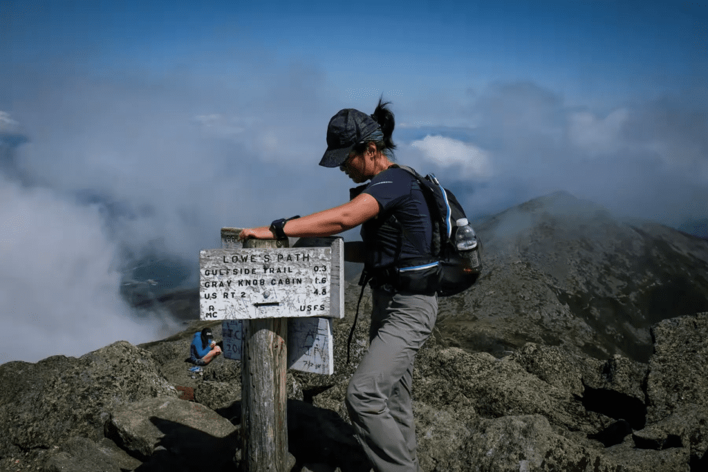
We quickly descended back to the hut, refilled our water, and left by 11:40 AM. A few people were already waiting for lunch by the big table. Our next water stop was the summit of Mount Washington—a distance of nearly 10 kilometers via Gulfside Trail. We were told that in hot weather, it’s best to carry three bottles of water each.
Mount Adams and Mount Jefferson
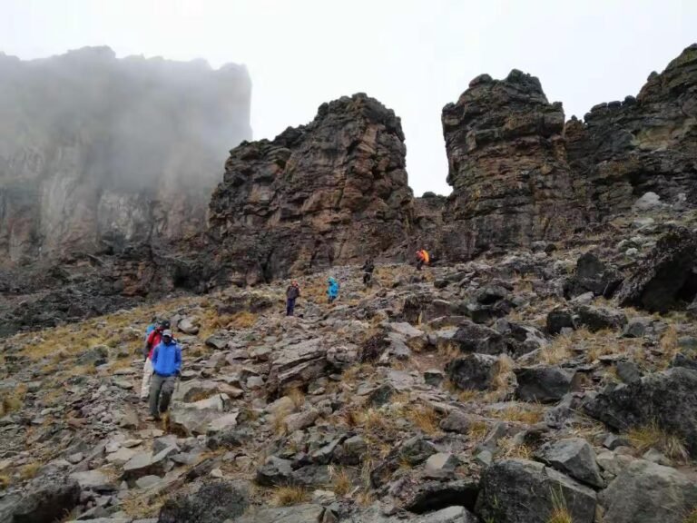
We started the long stretch of Gulfside Trail, and as we ascended Mount Adams, a brief mist rolled in. Named after the second U.S. president, Mount Adams is the second-highest peak in the Presidential Range. The summit was a jumble of rocks, which Tom found exciting—he loves running on terrain like this!
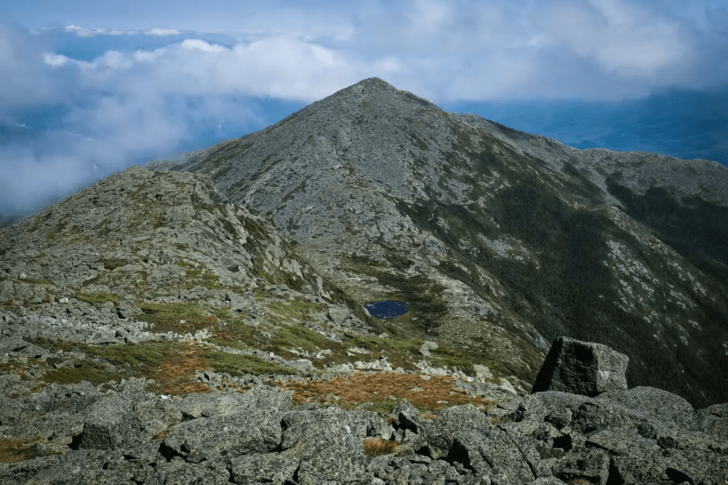
Each peak on the Presidential Traverse offers two route options: either take the loop trail to the summit or bypass the summit and continue on the main route. After Mount Jefferson, we continued along Gulfside Trail towards Mount Washington, still about 5 kilometers away.
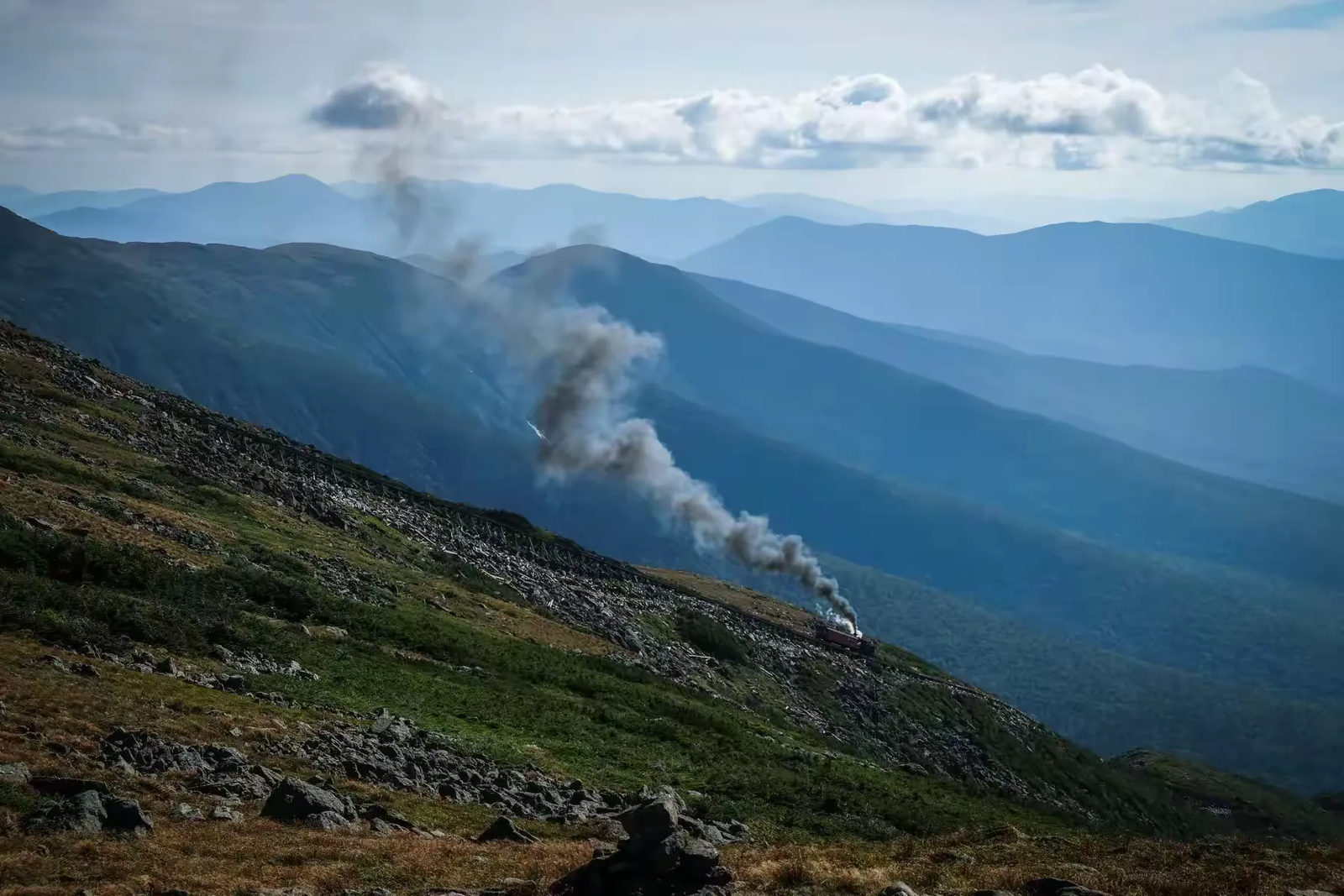
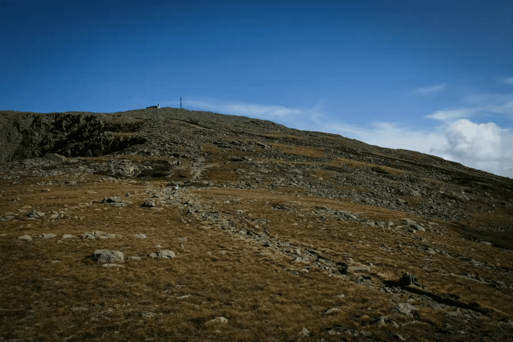
Mount Washington – The Highest Peak
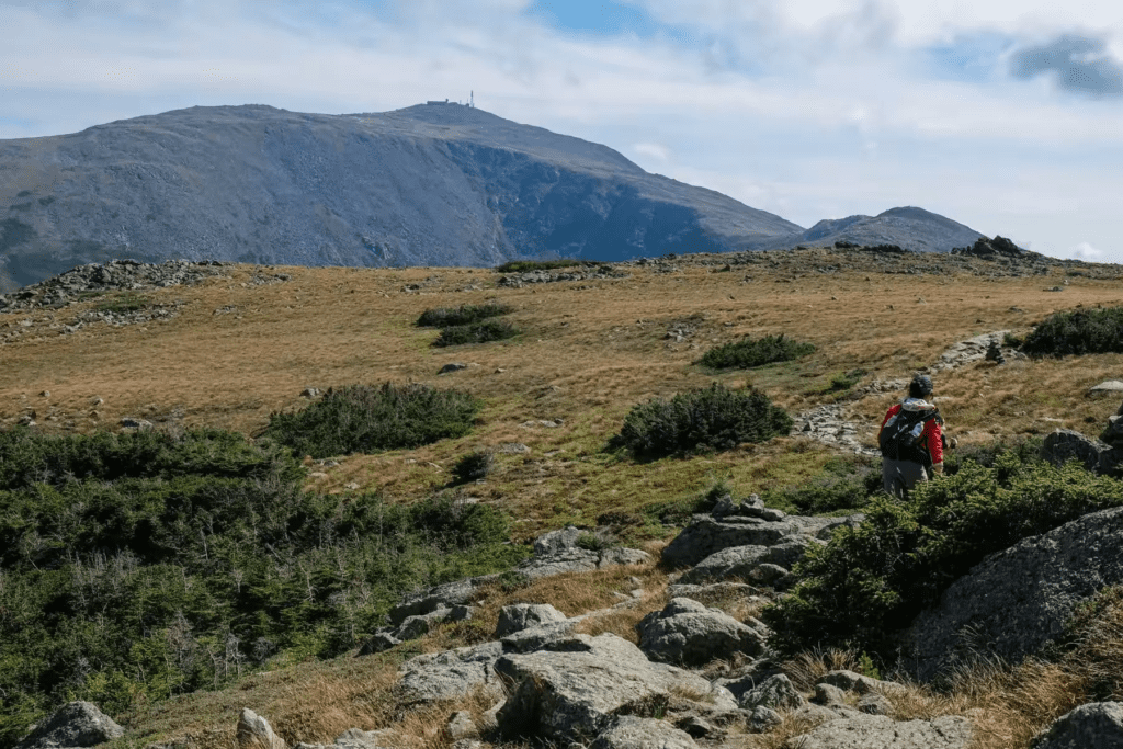
Mount Washington, the highest peak in New Hampshire and the tallest in the White Mountains, is famous for its harsh weather and breathtaking views. At the summit, there are steam trains that bring tourists up the mountain, and you can spot both hikers and train passengers exchanging waves, each enjoying the other’s perspective of the view.
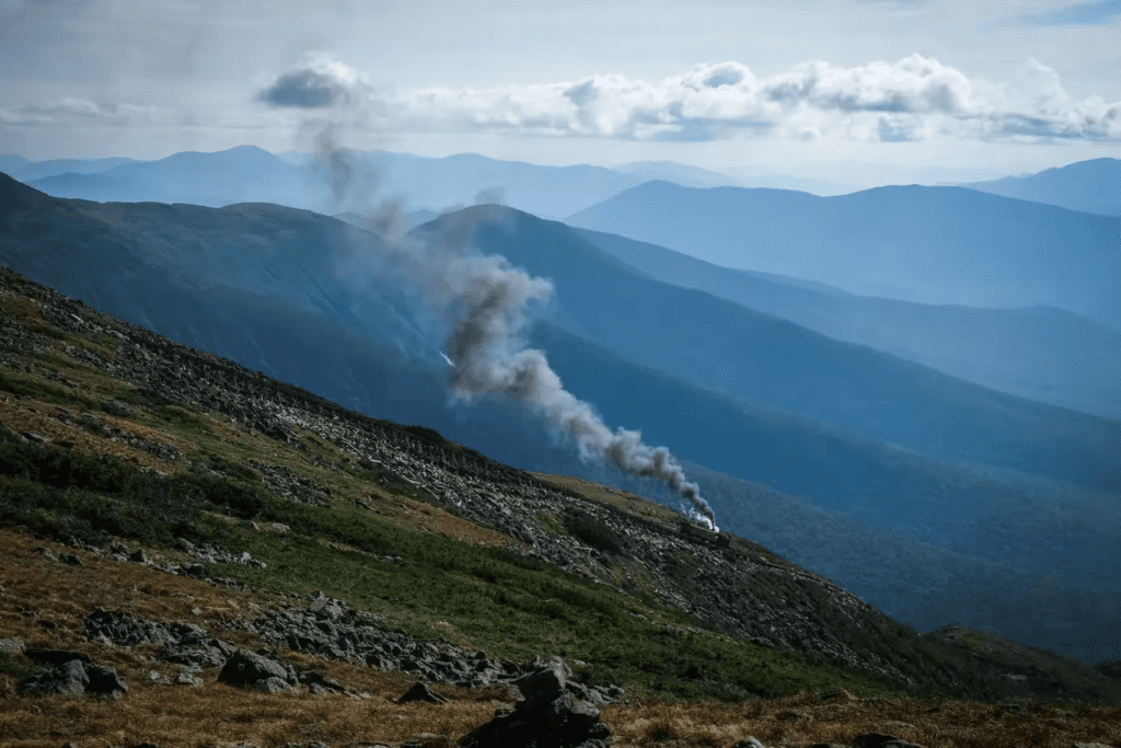
Later, Tom joked, “I really wanted to sneak onto the train and ride it to the top!”

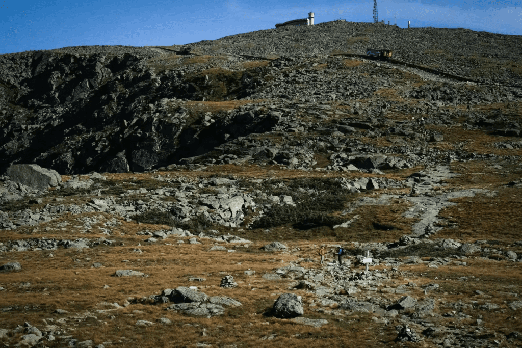
Before 5 PM, we finally reached the summit. I quickly rushed to the water station to get a drink. A young tourist asked me, “Is this drinking water?” I was too tired to respond properly, keeping my eyes fixed on the water faucet and muttering to myself, “Whatever.”
Suddenly, the atmosphere at the summit shifted. The tired, grumpy backpackers disappeared, replaced by well-dressed, relaxed tourists. The summit was bustling, and understandably so—it’s accessible by car and the cog railway.
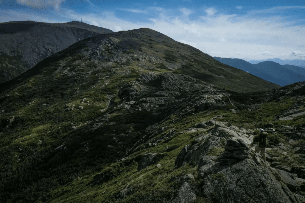
Heading to Lakes of the Clouds Hut


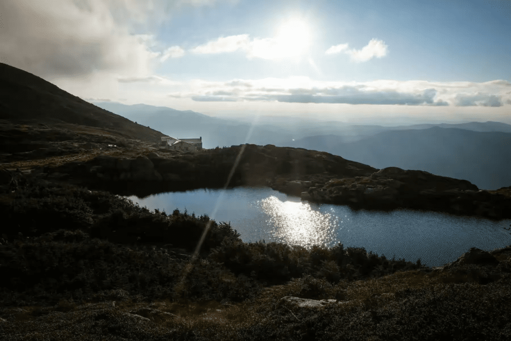
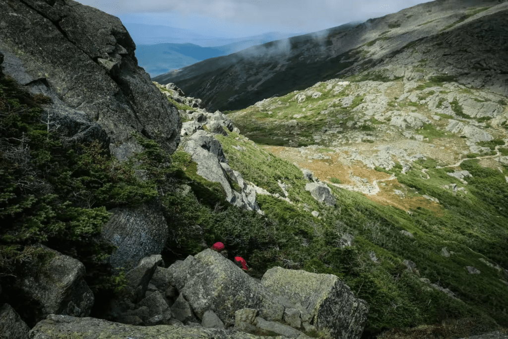
We couldn’t afford to linger for too long. The trail from Mount Washington to Lake of the Clouds Hut was still 1.2 miles away, and it would take us at least an hour to descend. As we descended, we followed Crawford Path, still stepping over rocks. The trail wound along the mountainside, and to keep myself motivated, I had to constantly remind myself to focus on the dinner waiting ahead, rather than the beautiful, distant roof of the hut. As I kept my mind on the goal, my footwork on the rocks became much more nimble.
Tom, taking advantage of his downhill prowess, stayed behind at the summit to take some photos. He lingered for what felt like two cigarette breaks but soon caught up with me. We were now at the beautiful Lake of the Clouds, right in front of the hut, with the towering Mount Washington in the background.

The two women we met earlier weren’t exaggerating. The path between Madison Spring Hut and Lake of the Clouds Hut is nothing but rocky terrain—large and small boulders. Even after crossing Mount Washington, the trail remains rocky, continuing on Crawford Path right up to the hut.
A Long Day’s Trek and a Well-Deserved Meal
By 6:30 PM, I opened the door to Lake of the Clouds Hut, after a 10.5-hour trek that covered 21.1 kilometers, with 3306 meters of elevation gain and 2187 meters of descent.
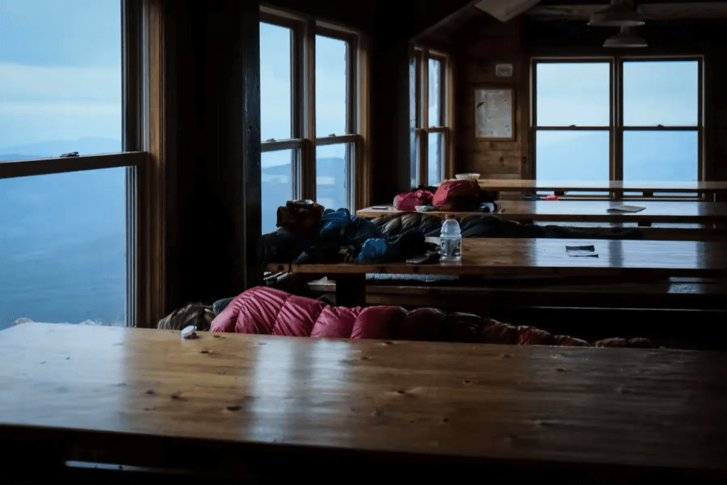
Dinner was served promptly at 6:00 PM, and the cozy dining room was already filled with fellow hikers. It seemed like everyone had gotten about 99% full before starting to chat with each other between bites.
The staff asked if we were hikers or guests. They checked the list and told us our room was number 5. Luckily, I got the bottom bunk by the window, while Tom had the top bunk across the room.
We threw our bags on the beds, splashed some cold water on our faces (there was no hot water here), and sat down at the dining table. Immediately, they brought out freshly baked bread, corn chowder, salad, mashed potatoes, peas, and roasted chicken breasts.
The couple we had passed on Gulfside Trail earlier arrived just in time for dinner. They had taken the Westside Trail to the hut, bypassing Mount Washington. We shared the table with them, and not long after, two more women showed up. They had missed out on the first batch of food, but the staff happily served them some extra pasta. No one was going to leave hungry!
The meal ended with the dessert, but by then, I was too full to eat any more.
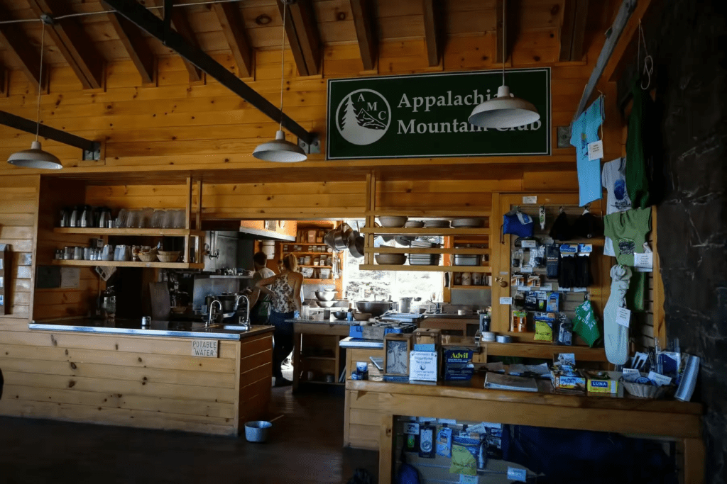
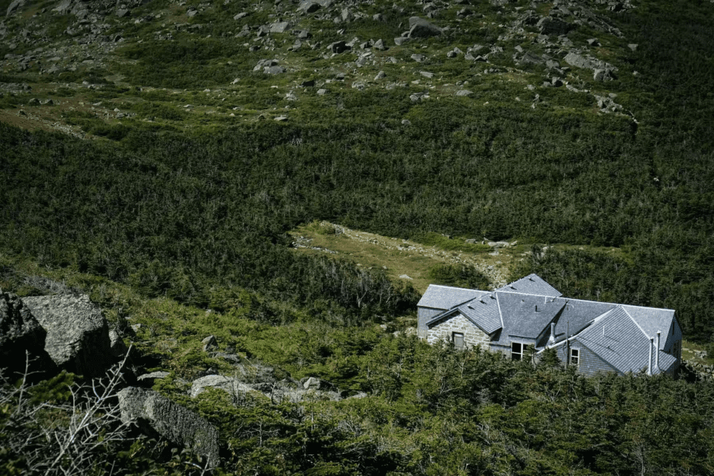
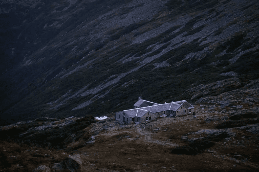
Largest Hut on Presidential Traverse
During dinner, the staff introduced themselves and told us a little about the hut. Lake of the Clouds Hut is considered one of the best in the U.S. and, although it’s called a “hut,” it’s actually a pretty large building that can accommodate over 90 people. The cost for one night, including two meals, is $139 on weekdays and $169 on weekends for non-members. It’s in high demand, so reservations must be made in advance through the AMC website.
The staff were all college students from different places, and I couldn’t believe how delicious the food was. Honestly, though, it probably tasted so good because we were all starving after such a long day.
The rooms accommodate about 10 people, each with three-tier wooden bunk beds that are too cramped to sit up straight. Everyone tried to be quiet and respectful, but the snoring made it hard to sleep. I thought I’d be too tired to be bothered by it, but I still didn’t sleep well. I had read reviews beforehand, so I brought earplugs, but I still only managed to get about two hours of sleep by the early morning.
Day Two: Easier Terrain, Lower Peaks

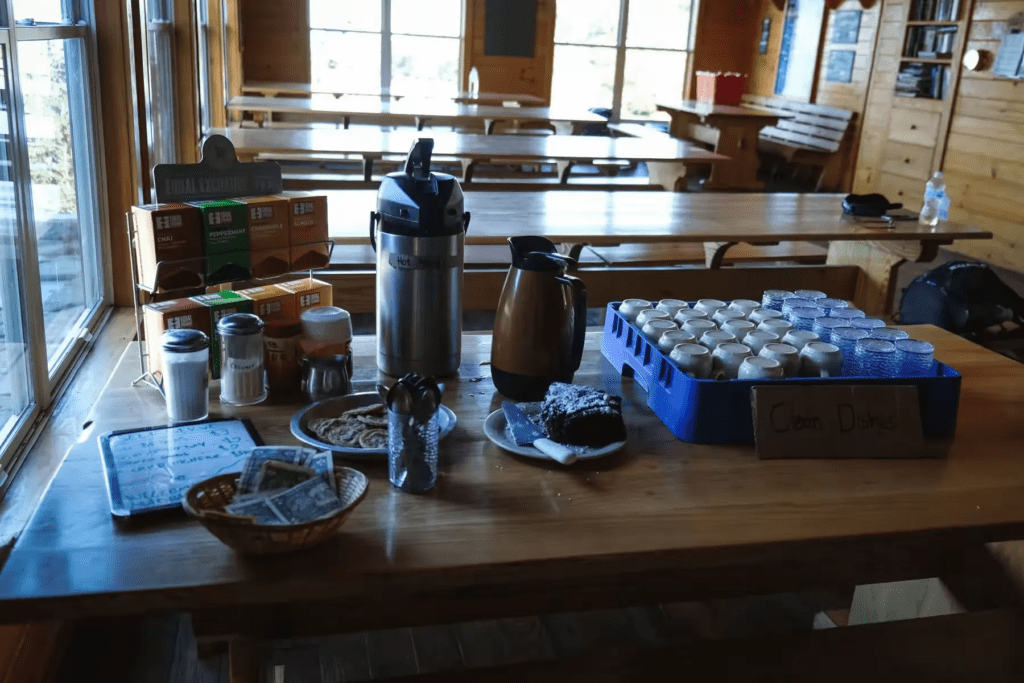
By 6:00 AM the next morning, people in the hallway and the rooms began to stir. We wanted to catch the 1:25 PM shuttle at the end of our hike, so we didn’t wait for the breakfast service at 7:00 AM. Instead, we left Lakes of the Clouds Hut by 6:30 AM. Thankfully, there was coffee and hot water available, which I paired with the three slices of bread I had saved from the night before.

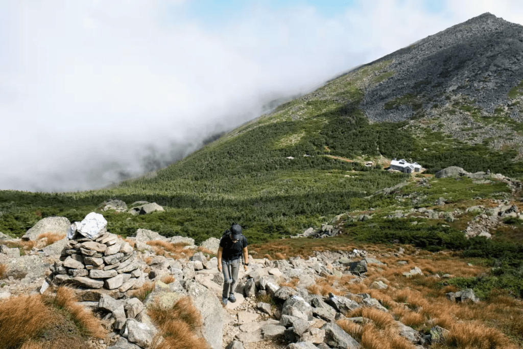
The first day was tough, but the second day was much easier—mainly because of the “rocky conditions” on the trail. As we left Lakes of the Clouds Hut, the rocks on Crawford Path became more refined, and the peaks of Mount Monroe, Franklin, Eisenhower, and Pierce seemed a little more modest compared to the big ones we conquered the day before.
We started early, the sky overcast and the air cool, giving us the mountain almost entirely to ourselves. The only other people we saw were a pair of thru-hikers, who told us they had started from the southern end on May 4th!

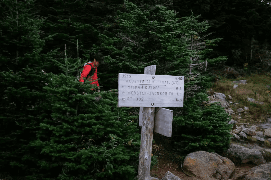
After passing Mizpah Spring Hut, the trail got busier, with more families dressed for day hikes, some with dogs and children.

We kept a steady pace, only slowing down to let hikers heading up the mountain pass. By 11:10 AM, we reached our destination, Highland Center/Crawford Notch. It was about 12 kilometers and took us 4.5 hours with an elevation gain of 500 meters and a descent of 1350 meters.
Tips on Hiking Presidential Traverse
If you’re planning your own Presidential Traverse, here are some tips based on our experience (check and pack 10 backcountry essentials)
- Two-Day Hike with Overnight at Lake of the Clouds Hut: If you’re able to start from Highland Center and head north, a two-day trek might be better for pacing. You can hike to Lake of the Clouds Hut on the first day and start early on the second day to summit Mount Washington. This way, you’ll spread the effort across two days, and the final stretch, Valley Way, will be mostly downhill. This north-to-south route is more popular and generally makes for a more leisurely three-day hike (the first night at Madison Spring Hut). Plus, it aligns better with shuttle bus schedules.
- Camping Option: If you enjoy camping, there are good spots after Mount Jefferson where you can set up a tent. It’s a great option if you want more flexibility and don’t mind carrying extra gear.
- Day Hike Only: If you’re short on time, you can always just do a day hike and then take the cog railway down from the summit of Mount Washington. There are also shuttle buses available, but they require a seat reservation and must be arranged in advance. For families traveling together, someone could drive up to visit the mountain, and the rest can be driven back down—no need to pre-book huts for this kind of visit since the mountains further down aren’t as scenic.
Overnight Accommodations on Presidential Traverse
There are three types of accommodations along the Presidential Traverse:
- Public Tent sites – These are campsites that you can use for free.
- RMC Huts – Simple huts operated by the Randolph Mountain Club.
- AMC Huts – The three upscale huts operated by the Appalachian Mountain Club. These are larger, more luxurious accommodations, but they come with a higher price tag since they include two meals per stay.
The Madison Spring Hut, where we passed before lunch, offers free cold water, while hot drinks and leftover baked goods from the morning are available for a small fee (about $1 or $2). You can just drop the money in the box!
Lakes of the Clouds Hut, despite being fully booked, can’t turn away any hiker seeking shelter. It’s too dangerous to attempt crossing Mount Washington at night, given its unpredictable weather, so the hut will always welcome hikers. Tom joked that had we known, we would have brought our sleeping bags to the main dining area—it was so crowded in the rooms!
This morning, we passed Mizpah Spring Hut, the third hut on the Presidential Traverse. It was a bit quieter, with the door to the restroom wide open and the rooms freshly cleaned. The sleeping areas were small, with fewer beds, making it a much quieter and restful place compared to Lakes of the Clouds Hut.

Where to Stay Before or After Presidential Traverse
Like us, you may need to stay at least one night near the trailhead – either before starting the Presidential Traverse or after finishing it. The two most convenient towns are North Conway and Gorham. North Conway offers more lodging choices, restaurants, and gear shops, while Gorham, that we stayed, is quieter and closer to the northern trailhead (Appalachia).
- Find places to stay in North Conway on Booking.com
- Or check out options in Gorham on Booking.com
Found the info useful for your hike planning? Consider supporting the blog—just click the orange “Buy Me a Coffee” button (bottom-left corner), thank you!

Dear skihiketravel.com Admin!