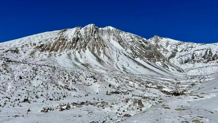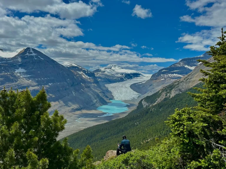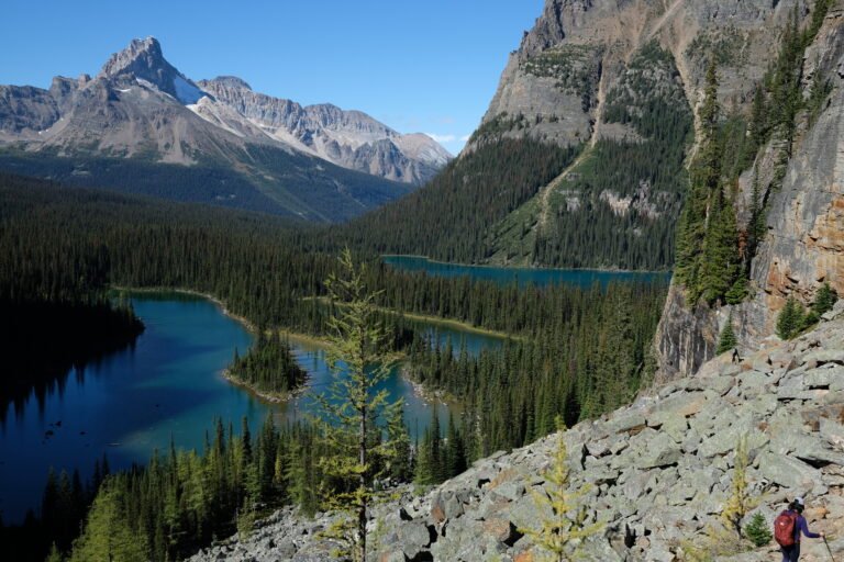

Over the 2026 Labor Day long weekend, my husband, our friend Kim (who lives in Revelstoke), and her dog Bailey tackled the Perley Rock Trail together. What drew us in wasn’t just the big mountain views and glaciers – plenty of trails in Glacier National Park have those. But the Perley Rock Trail is the one that takes you right to the toe of the glacier, where you can actually step onto the Illecillewaet Glacier itself.
If you’re planning to hike the Perley Rock Trail, this guide should help. I’ll share our firsthand experience, the practical things we ran into, and the latest 2026 regulation updates.
Perley Rock Trail Overview
The Perley Rock Trail is in BC’s Glacier National Park, about a 40-minute drive from Revelstoke. The trailhead is at Illecillewaet Campground, and the whole route winds through stunning valleys and glacier scenery.
| AllTrails stats | Our stats (from Strava) | |
|---|---|---|
| Distance (round trip) | 12.2 km | 14.2 km (we wandered around the glacier lake) |
| Elevation gain | 1,275 m | 1,439 m+ |
| Our time | — | 7 hours 40 minutes (including 1 hour at the top) |
| Difficulty | Hard | Hard, but no technical climbing |
| Season | July to early October | — |
| Highest point | ~2,386 m | — |
| Dogs allowed | Yes, must be on-leash | — |
In our opinion, the Perley Rock Trail is best for people with some hiking experience under their belt – comfortable with sustained climbing, rocky terrain, and good stamina. I wouldn’t recommend it for beginners.
Getting to the Perley Rock Trailhead
From Revelstoke, head east on Highway 1 for about 40 minutes. As you get close to Rogers Pass, watch for the dark green Glacier National Park sign for Illecillewaet Campground. The turn is a sharp right-hand bend—easy to miss if you’re not paying attention, and cars come fast on that curve, so slow down well before it.
Coming from Golden: it’s about 86 km, just over an hour. After you pass the Rogers Pass Discovery Centre, keep an eye out for the campground entrance on your left. You can’t turn left directly there because of the curve – you’ll need to continue to Loop Brook, turn around, and come back.
The parking lot isn’t huge: two sections with maybe 20-odd spots total. We arrived at 10:30 am on Labor Day Monday and ended up parking on the shoulder. I’d suggest getting there early – before 9 am if you can.
Camping and 2026 Changes
If you’re thinking of staying at Illecillewaet Campground the night before your Perley Rock Trail hike, pay attention to this new 2026 rule:
Starting August 3, 2026, Illecillewaet Campground is hard-sided camping only. No tents, rooftop tents, or tent trailers allowed.
Glacier National Park Frontcountry Campgrounds – 2026 Season
From Parks Canada’s website, here’s what’s open in 2026:
| Campground | 2026 Dates | Sites | Booking | Key Amenities |
|---|---|---|---|---|
| Illecillewaet | Jun 19 – Oct 12 | 60 | 50% reservable, 50% first-come | Flush toilets, drinking water, bear lockers, kitchen shelter, firewood (permit required) |
| Loop Brook | Jun 26 – Oct 12 | 20 | Reservations only | Flush toilets, drinking water, bear lockers, kitchen shelter, firewood (permit required) |
| Mount Sir Donald | Indefinitely closed | 15 | — | — |
A few extra details:
- Illecillewaet Campground: 3 km west of Rogers Pass and the actual trailhead for the Perley Rock Trail. Starting in 2026, half the sites (30) can be booked on the Parks Canada website; the rest are first-come, first-served. No showers or electrical hookups. Limited space for big RVs.
- Loop Brook Campground: 5 km west of Rogers Pass, known for the old stone railway bridge pillars at the entrance. In 2026 it’s reservations only. If you show up without one, you can check with Illecillewaet to see if they have space. It’s smaller and more private.
- Mount Sir Donald Campground: frontcountry campground is closed indefinitely – not available.
Backcountry Camping
If you’re planning a multi-day backcountry trip before or after the Perley Rock Trail, Glacier has two backcountry campgrounds:
| Campground | 2026 Dates | Sites | Booking |
|---|---|---|---|
| Hermit Meadows Backcountry | Jul 1 – Oct 1 (snow-dependent) | 8 | Bookable via Parks Canada |
| Sir Donald Backcountry | Jul 1 – Oct 1 (snow-dependent) | 4 | First-come, first-served (register at Illecillewaet) |
Both are up high. The trails to get there are short but very steep – hauling gear up is no joke. Facilities are basic: pit toilets and bear-proof food storage. No campfires – gas stoves only.
AO Wheeler Hut: An Alpine Hut Option
If you’d rather not camp but still want to stay near the trailhead, the AO Wheeler Hut is an option. It’s a backcountry hut run by the Alpine Club of Canada.
AO Wheeler Hut basics:
- Type: ACC-run backcountry hut
- Location: Rogers Pass area, Glacier National Park
- Facilities: Basic hut amenities—check the ACC website for specifics
- Booking: Must be booked through the Alpine Club of Canada website, separate from Parks Canada’s system
Other ACC huts in the park include Asulkan Hut and Sapphire Col Hut—good options for more experienced alpine hikers or skiers.
Lodging in Revelstoke and Golden
If camping isn’t your thing or you want a bit more comfort, Revelstoke and Golden are the two closest towns. Parks Canada’s website recommends both.
- Revelstoke: about 60 km west of the park, 40 – 60 minute drive. Lots of hotels, restaurants, and grocery stores. Many hotels are pet-friendly – just double-check when you book.
- Golden: about 86 km east, roughly an hour away. Equally well-stocked. Just remember that if you’re coming from Golden, that campground turn is tricky – you can’t turn left directly; you’ll need to loop around.
Perley Rock Trail – Our Hike, Step by Step
Section 1: Forest and Boulder Field (0–2 km)
Right at the trailhead, there’s a small Parks Canada office where you can handle camping check-ins and ask rangers about trail conditions. They also sell maps for $1 – though the same map is free at the Rogers Pass Discovery Centre. There’s a pit toilet here too.
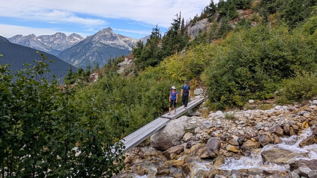
The Perley Rock Trail shares its start with several other trails in the park, so watch for signs. The first kilometer is relatively flat forest walking, gentle uphill, with the Illecillewaet River rushing along on your right.
Around the 1.7 km mark, things change. A massive boulder field spreads out in front of you—debris from an old avalanche. The rocks vary in size but are mostly flat (thanks to park maintenance, I think), so they don’t roll much, but you still need to watch your footing. Look for the small rock piles (cairns)—they’re your most important navigation markers on the Perley Rock Trail.
Section 2: Waterfall Roar and the Junction (2–3.2 km)
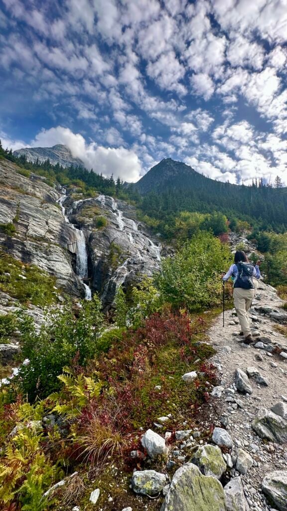
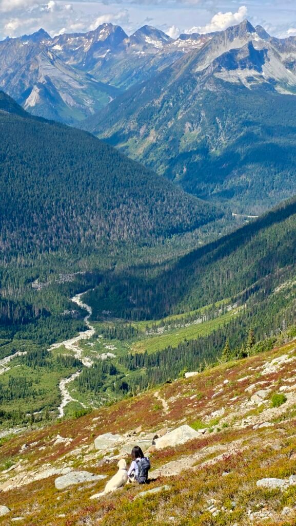
After the boulder field, it’s pretty much continuous climbing all the way to the top. You cross several metal bridges over rushing glacial meltwater—loud enough to drown out conversation. The views start to open up, with waterfalls cascading down the mountain on your left, including a three-tiered one that’s especially pretty.
At the 3.2 km mark, you hit a junction with a sign: left goes to Sir Donald, right goes to Perley Rock – our goal for the day.
Section 3: The Switchbacks (3.2–5.5 km)
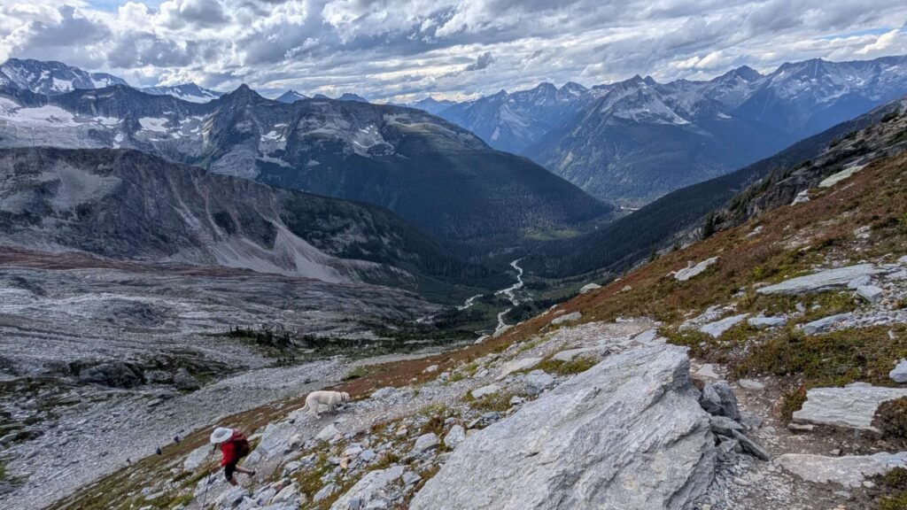
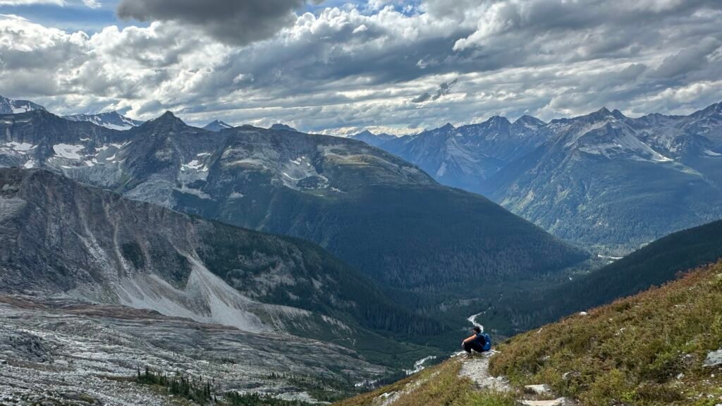
After the junction, the real challenge begins – endless switchbacks going up and up and up. Almost no shade, completely exposed on the ridge, with the sun beating down. Every turn takes you higher. Look down and the valley gets deeper, the Illecillewaet River a silver thread snaking through the bottom. Look up at the slope ahead and you’ll see big patches of red tundra covering the hillside.
This is one of the best parts of the Perley Rock Trail: every switchback changes the angle on Mount Sir Donald’s pyramid peak and the tongue of the Asulkan Glacier. The higher you go, the bigger the view, the more stunning it gets.
Section 4: Rocky Traverse (5.5–6.5 km)
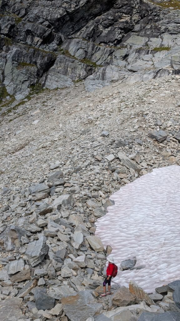
The last stretch before the top is rocky and uneven, lots of big rocks and small ones, some stable, some wobbling when you step on them. You need to watch your footing carefully and test each step before putting your weight down. There’s one section where you almost hug the rock wall and edge across – probably the most balance testing part of the whole hike. We were lucky: on September 6, that traverse was snow-free. I can’t imagine slipping there – it’ll be a long, steep drop. For high-elevation hikes like this, it’s usually safer to wait until mid-to-late August.
Section 5: Moon Landscape and the Glacier Lake (6.5 km+)
The moment you crest the final ridge (the Col), the view explodes in front of you.
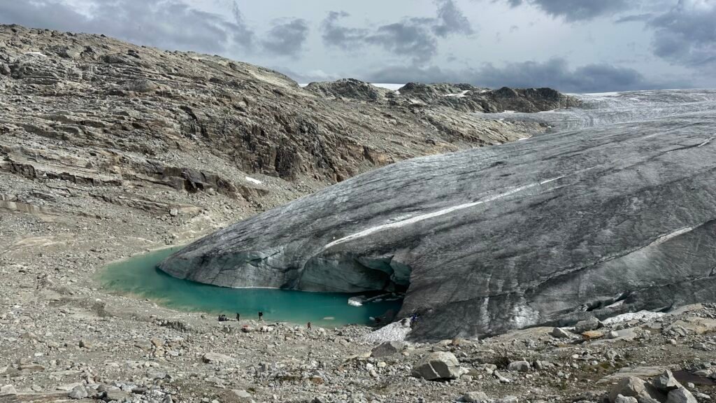
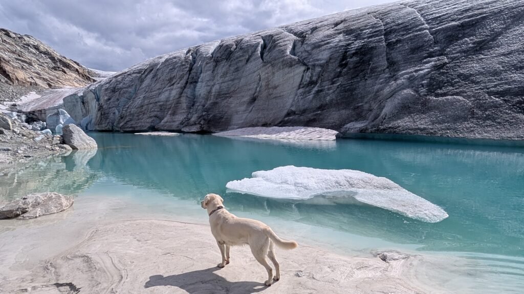
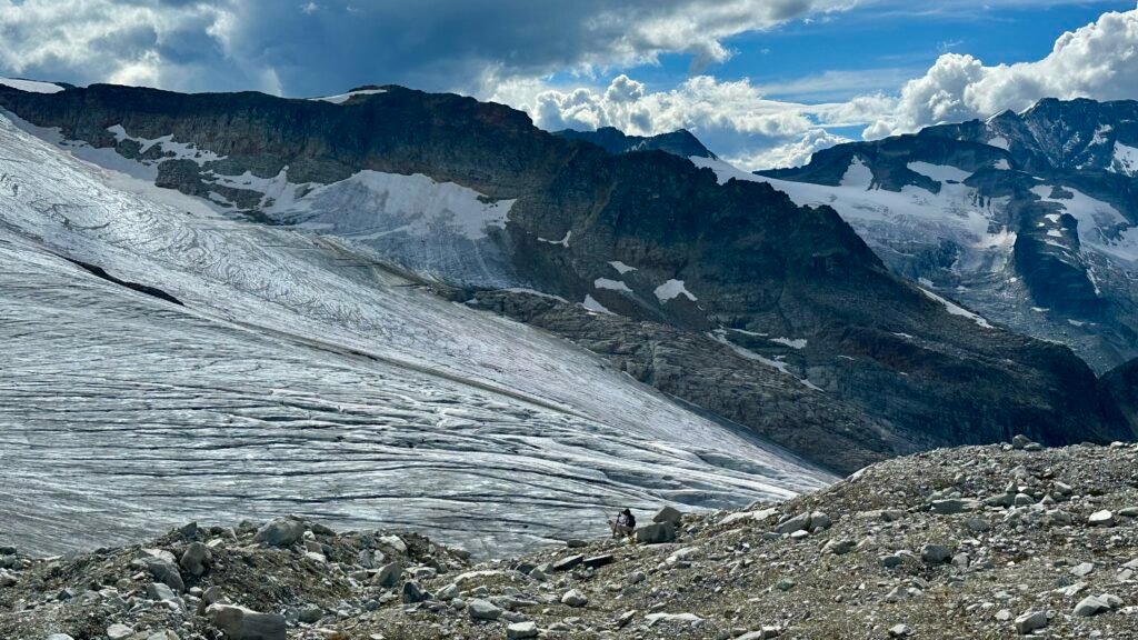
A vast, grey-white rocky wasteland spreads out – barren, almost like the surface of the moon. Illecillewaet Glacier sits right ahead, a giant white beast sprawled across the mountains, its surface cracked with deep, brilliant blue crevasses. This, more than anything, is what makes the Perley Rock Trail so unique.
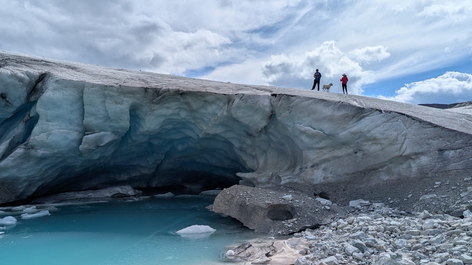
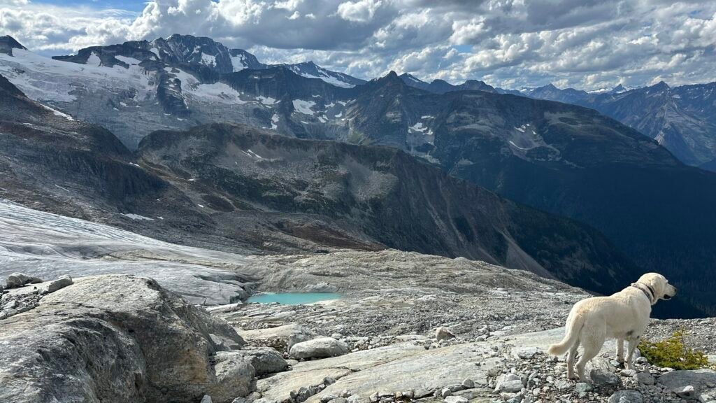
We followed the faint path across the tundra for a few hundred meters and walked right up to the toe of Illecillewaet Glacier. You can reach out and touch ice that’s been there for thousands of years. Below it is a milky-green glacier lake – the water shifts from white to pale green to deep green, colored by the fine rock flour (glacier flour) suspended in it. Bailey saw the water and charged straight in – it must have been close to freezing, with chunks of clear ice floating near the shore.
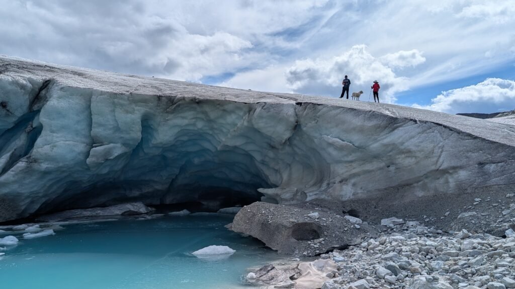
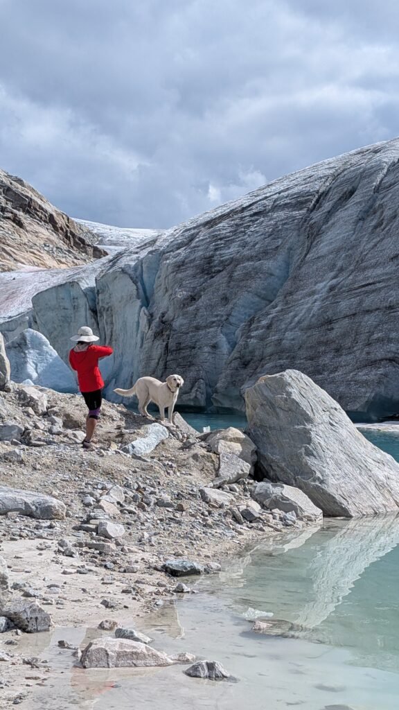
We spent a long time at the glacier’s edge, walking all the way around the lake. After lunch by the shore, we stepped onto the glacier itself, crunching across the glittering, granular surface – feeling what it’s like to stand on ice that’s been here for millennia. On the right side of the lake there was an ice cave glowing with deep blue light. Ice can fall from the ceiling at any moment, so when you’re on the glacier, stay well away from the top of that cave.
The tundra up here is huge. A short scramble up Perley Peak gave us an even bigger view: the full sweep of the Illecillewaet Icefield spread out before us, a frozen white ocean stretching south until it met the horizon and the surrounding peaks. Facing the glacier, Abbott Ridge was clearly visible off to the right -another famous hiking route in Glacier National Park. And tucked below us, nestled between the rocks, was a jade-colored glacier lake we hadn’t noticed from below.
Downhill Isn’t Easier
Uphill works your legs; downhill works your knees. The Perley Rock Trail descent is all steep, rocky terrain, and by that point your energy is already spent. You need to concentrate on every step – especially through the boulder field – to avoid twisting an ankle or taking a spill.
We had good weather, but some rocks and roots were still slippery. Both Kim and I took a tumble at different points. The switchback section is exposed, and if the weather turns wind or rain, it slows you down and makes things more uncomfortable.
Perley Rock Trail Safety Tips
- Start early. The Perley Rock Trail takes 6–9 hours, and most people spend extra time at the glacier lake for lunch and exploring. Make sure you have enough daylight for the way down.
- Bring enough water, and a filter. There are streams along the way to refill, but glacial water has fine sediment and microbes – filter it before drinking.
- Watch the weather. Mountain weather changes fast. Large sections – especially the switchbacks – are fully exposed with nowhere to hide from wind or rain.
- Carry bear spray. This is grizzly and black bear country, especially on the forested lower sections.
- Use trekking poles. They save your knees on the descent and add stability on loose scree.
- Check out our full backcountry gear list for more on what we packed.
A Few Extra Notes on Hiking the Perley Rock Trail
- You’ll need a Discovery Pass (annual) or a day pass for Glacier National Park.
- There are no garbage bins on the trail – pack out everything you bring in.
- The only toilet at the trailhead is a pit toilet by the parking lot – but I found it nicer to walk behind the Parks office booth to the campground washroom, which has flush toilets.
- After Labor Day, the weather gets iffy. By October, snow is likely.
Hope you find your own special moment on the Perley Rock Trail. If you have questions, drop a comment and I’ll do my best to answer.