Why the Iceline Trail Loop?
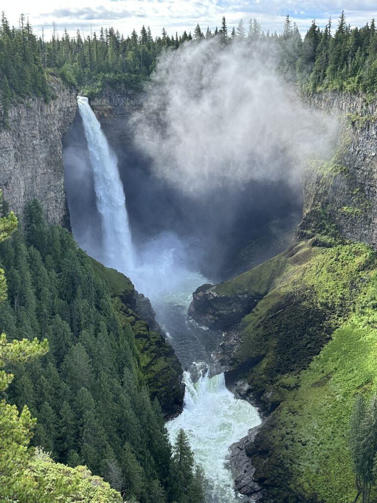
Yoho National Park is full of iconic sights, but if there’s one trail that captures the park’s essence beyond Lake O’Hara, it’s the Iceline Trail Loop. This loop takes you above treeline, across glacial moraines, past wildflower meadows, and gives you front-row views of Takakkaw Falls (Canada’s second-highest waterfall). It’s a hike where the scenery keeps changing — from shady forest to stark alpine to roaring rivers — all in a single day.
Quick Facts of Iceline Trail Loop
From my Alltrails record:
- Trail name: Iceline, Little Yoho Valley and Yoho Valley Trail Loop
- Distance: 22.6 km (loop)
- Elevation gain: 1056 m
- Time needed: 6.5 hours moving time, total 7:14 hours
- Difficulty: Moderate to challenging, depending on fitness
- Best season: Late June to September
- Trailhead: Takakkaw Falls parking lot or Whiskey Jack Hostel lot for the out-and-back option
Route Choice – Why We Went Counter-Clockwise
There are several ways to experience the Iceline Trail. If you’re short on time, the out-and-back to the alpine “summit” viewpoint is the most efficient. But if you can devote a full day, the Iceline Trail Loop is worth every step.
We chose to go counter-clockwise for Iceline Trail Loop, starting on the Yoho Valley Trail and ending with the Iceline descent:
- The ascent is more gradual, making it easier on the legs.
- The price: a steep downhill at the end, which can be hard on the knees.
- If you’d rather front-load the climb and enjoy a steady descent, go clockwise.
Our Day on Iceline Trail Loop
Yoho Valley Trail
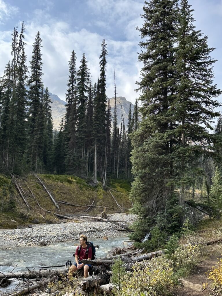
On September 15, at 9:25 a.m., we set out from the Takakkaw Falls campground along the Yoho Valley Trail. The first stretch meanders through forest. It’s quiet and shaded – a good warm-up.
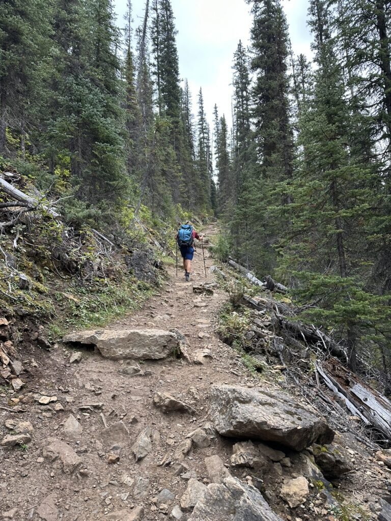
The trail follows the Yoho River, very flat and beautifully maintained by Parks Canada. Along the way we passed two or three pairs of day hikers – likely those who had gone to see Laughing Falls early in the morning and were now returning. We also met a few backpackers carrying large packs, coming back from backcountry camping. On this loop, besides one Alpine Club of Canada hut, there are two backcountry campgrounds. Outside the loop, there are also several more trails and a couple of additional campgrounds.
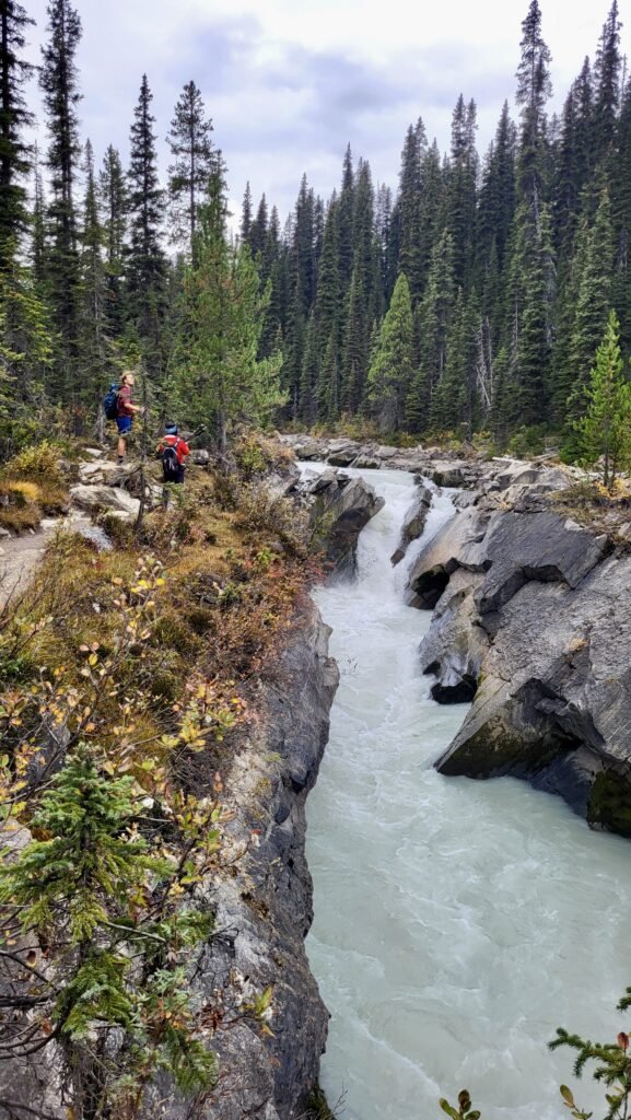
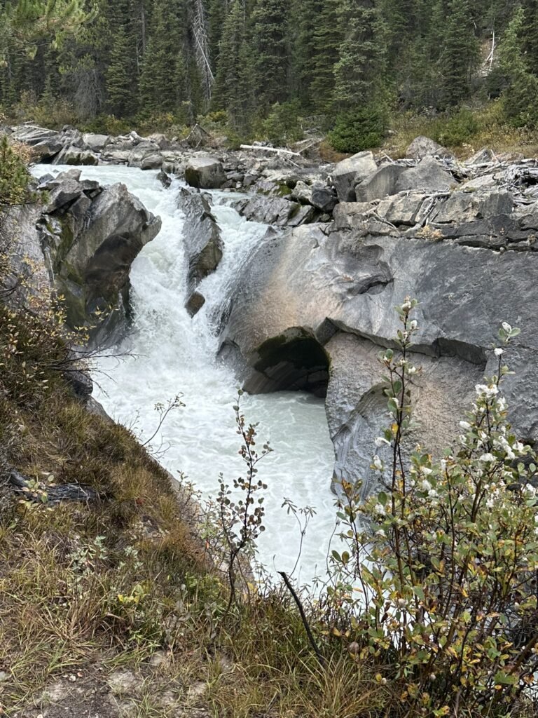
The first waterfall we passed was Laughing Falls, on our left-hand side. On the right is Laughing Falls backcountry campground, completely empty at the time. From the timing, we guessed that the hikers we met earlier had likely camped here the night before. I made a restroom stop here before we continued on.
Little Yoho Valley Trail
At Laughing Falls, the trail splits. If you continue on the Yoho Valley Trail, you can reach Twin Falls, where there’s also a backcountry campground. Including this section would extend the loop to 29 km, and some hikers choose to complete it over two days.
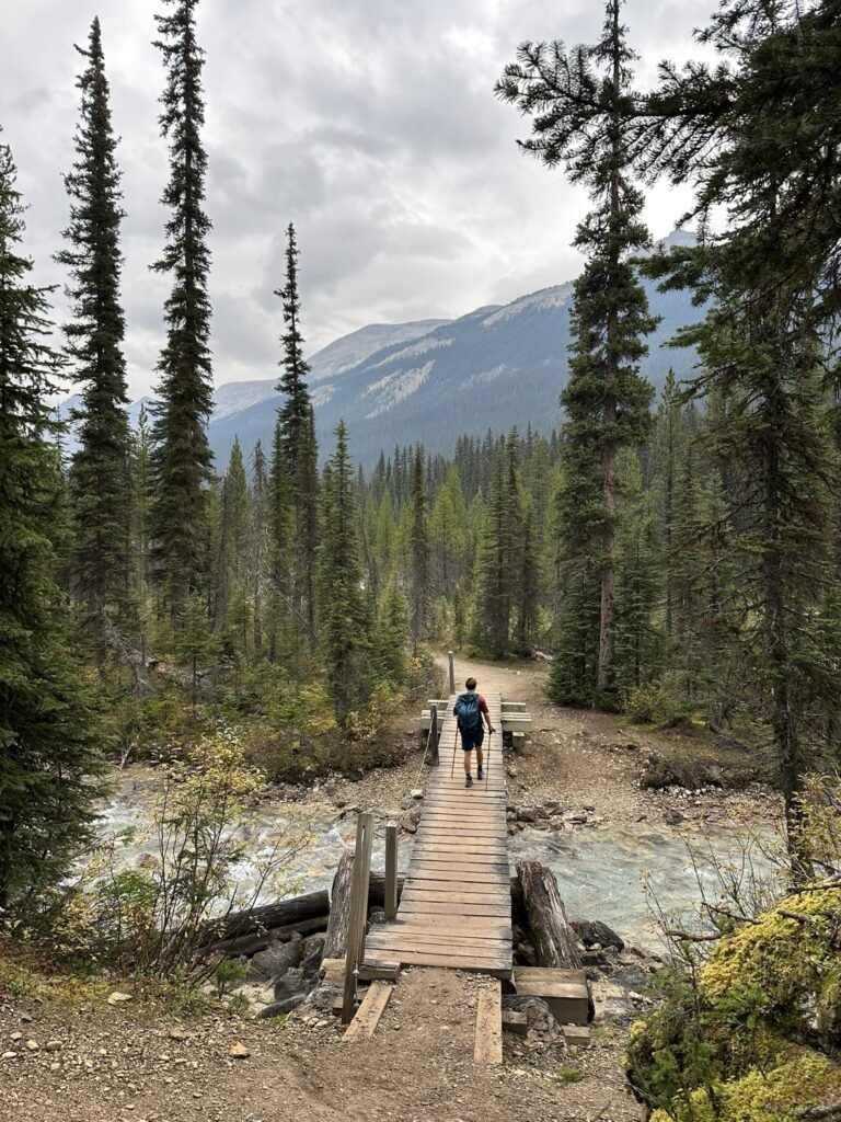
On the Little Yoho Valley Trail, the ascent gradually increases. As elevation rises, the views begin to open up. We crossed the Little Yoho River several times along the way.
ACC Hut and Entering the Iceline Trail
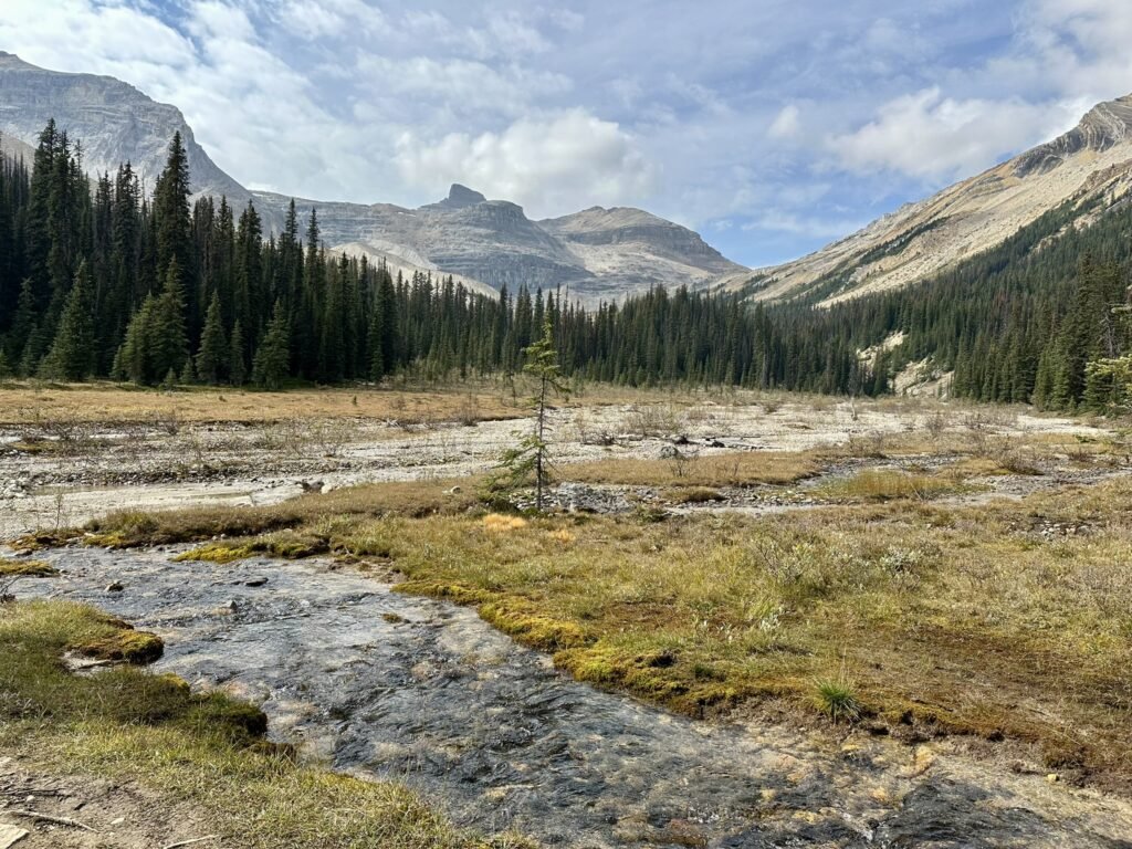
Around noon, we reached the junction of the Little Yoho Valley Trail and the Iceline Trail, marked by the Stanley Mitchell Hut – an ACC alpine cabin nestled in the valley. Nearby is the Little Yoho Valley backcountry campground. In front of the hut lies a wide grassy meadow surrounded by towering peaks, making it a perfect spot for a lunch break. We had a quick meal and explored some of the nearby side trails.
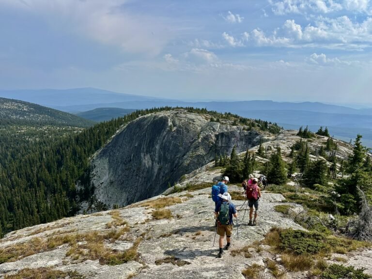
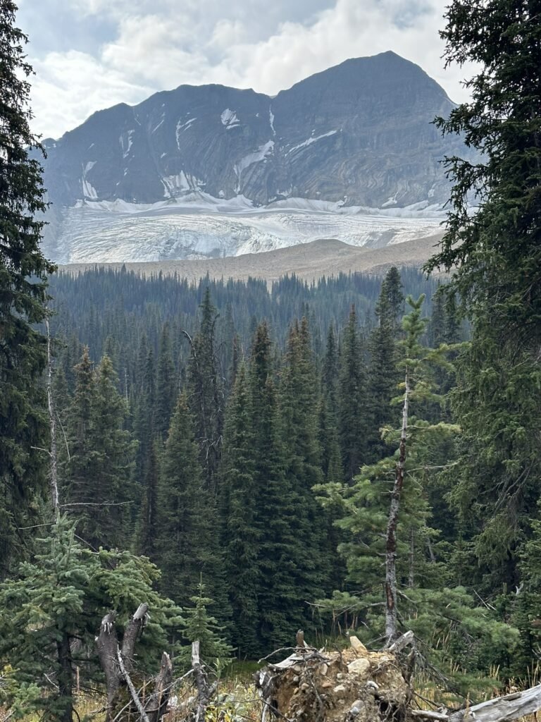
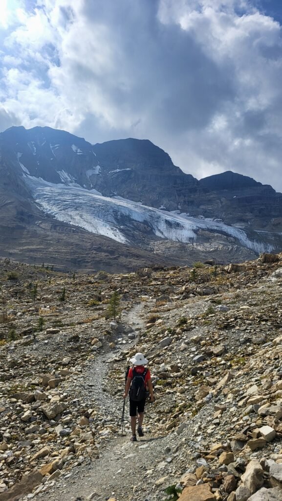
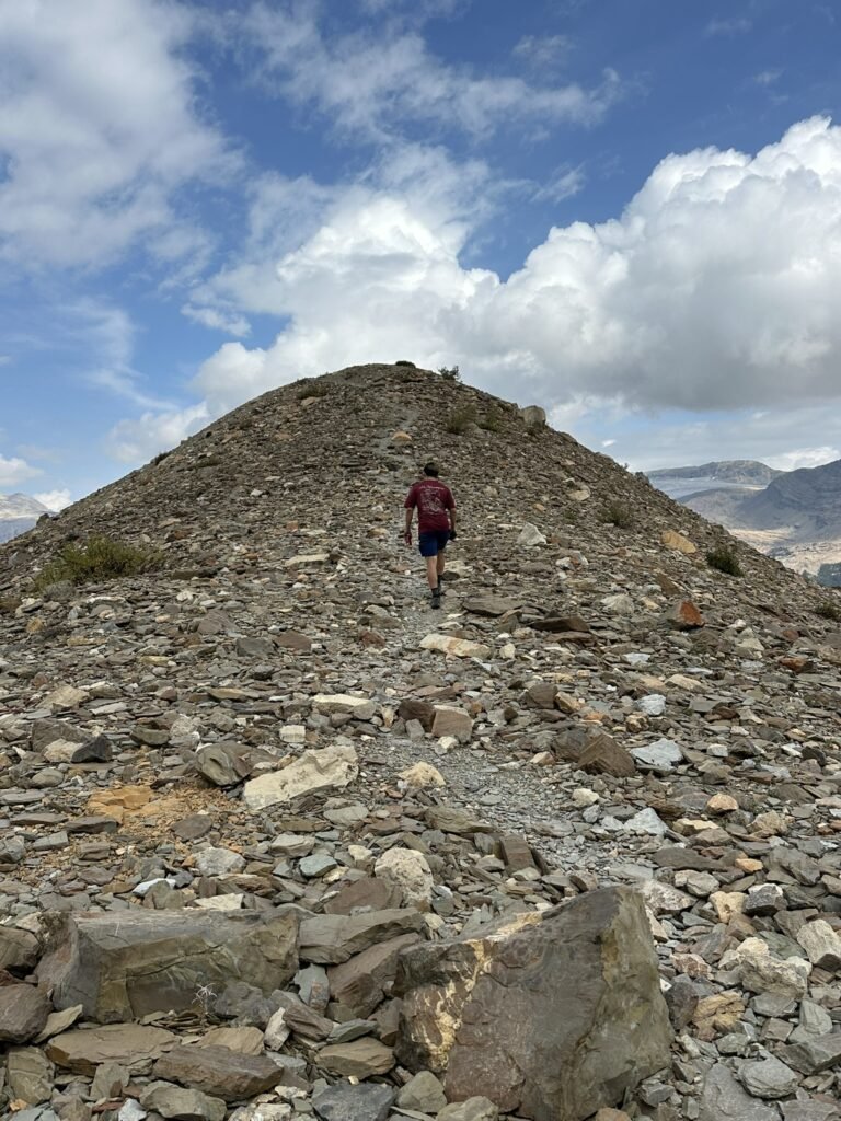
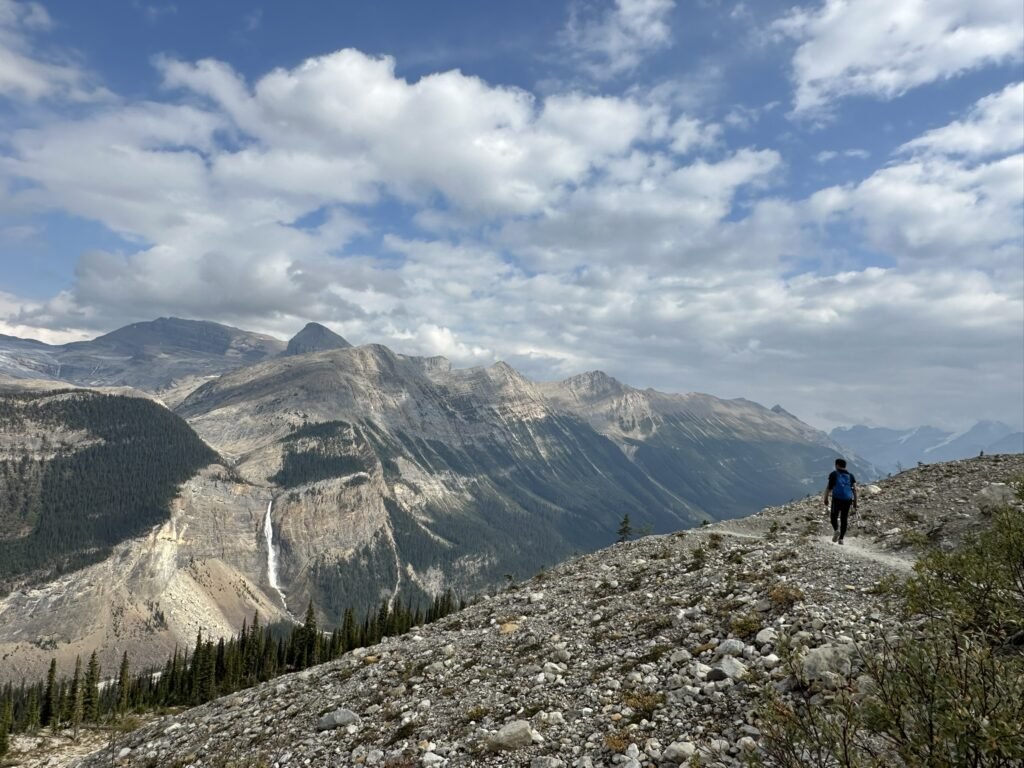
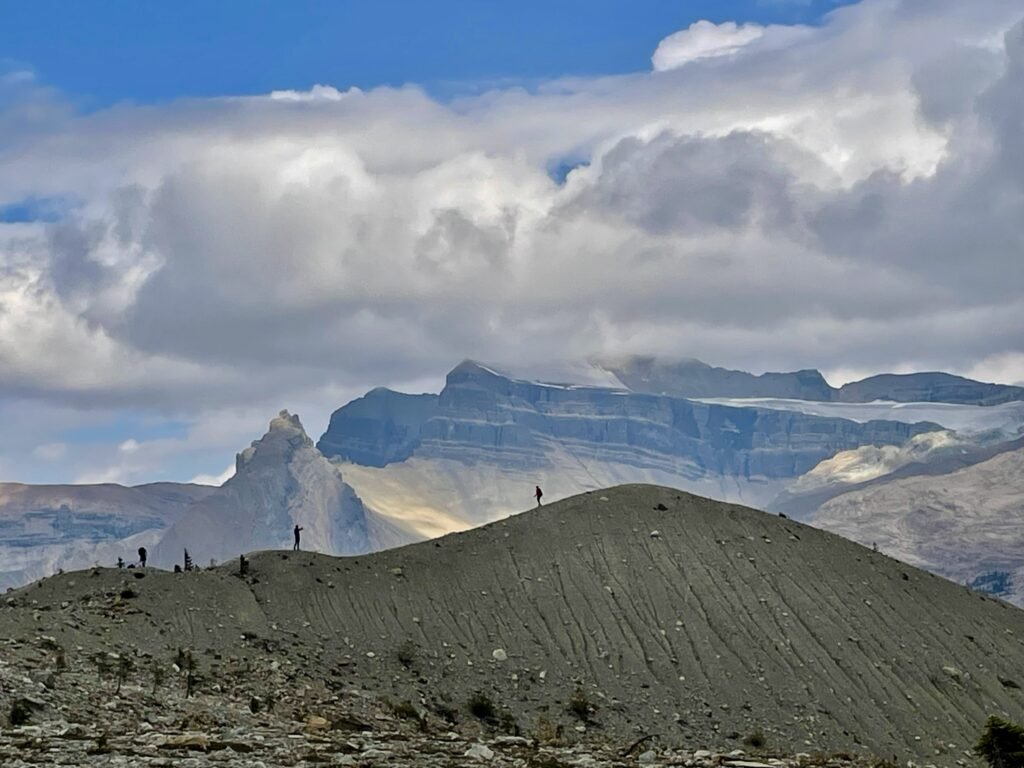
Entering the Iceline Trail marked the highlight of the day, as the dramatic scenery began to unfold before us. In hindsight, we felt that hiking the loop counterclockwise was the best choice. As we climbed higher, the forest thinned out, and it felt as though only rocks and glaciers remained in conversation with the sky.
The weather was overcast, with occasional soft sunlight breaking through the clouds and casting a gentle glow on the ridgelines. Without harsh sun exposure, the cool temperature made hiking especially pleasant.
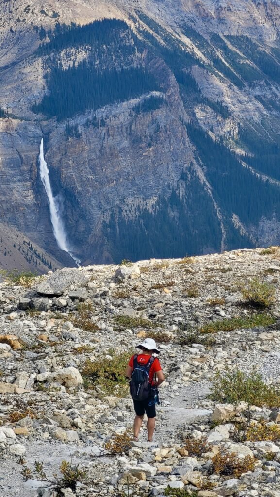
Around 1 p.m., we reached the ridge. Every step along this section was breathtaking. By 2 p.m., we arrived at the Iceline Summit – a modest rise, but from there, we finally saw Takakkaw Falls again!
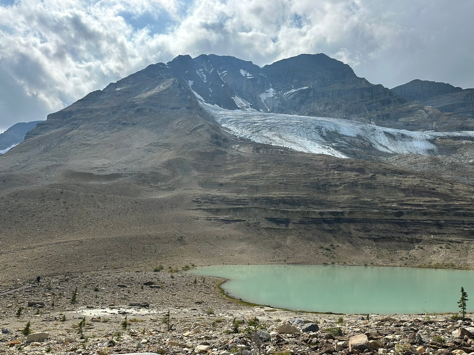
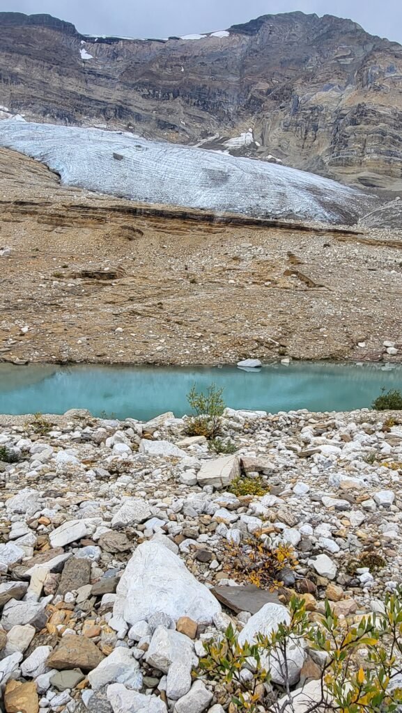
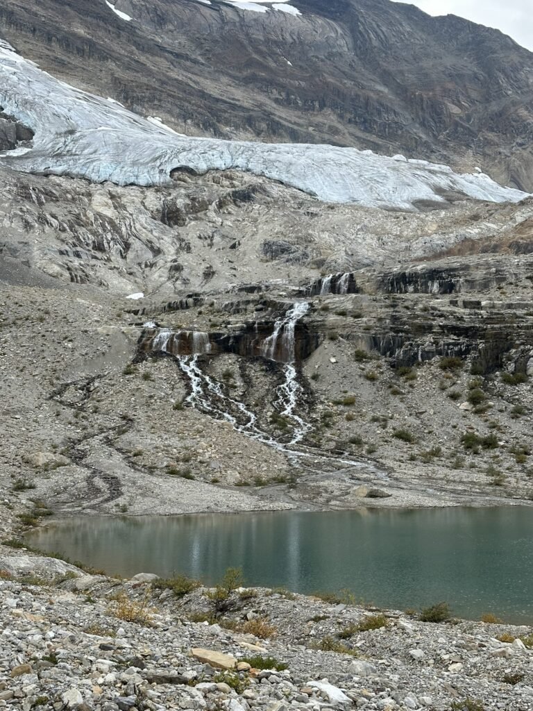
The rocks underfoot began to show vivid layers of color—purples, reds, yellows—like gemstones polished by centuries of glacial movement. Glaciers near and far shimmered with a bluish hue beneath the clouds, silent and majestic, as if time itself had paused.
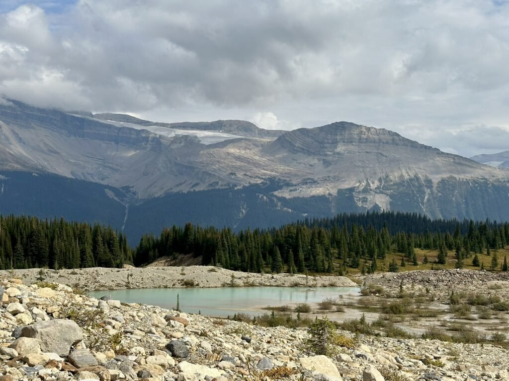
We passed two or three glacial lakes, some milky green, others pale white. Streams burst from cracks in the rocks, forming small waterfalls that danced through the valley. The crisp sound of flowing water added a lively rhythm to this icy landscape.
Descent: Returning to the Embrace of the Falls
Around 3 p.m., we began our descent. The trail felt unusually long, as if the valley itself was stretching time, reluctant to let us go. Each step down seemed to take forever. Thankfully, it was all downhill – effortless and smooth. We couldn’t help but feel relieved that we had chosen the counterclockwise direction. Had we started from here in the morning and gone clockwise, the steep uphill would have been exhausting.
My son, still full of energy, found the day’s hike quite easy and even added a detour to Yoho Lake. He hiked over 4 km more than we did, yet arrived at the finish almost at the same time. Youth has its perks!
As Takakkaw Falls reappeared in our view, we knew the end was near. The first place we reached after descending was the Whiskey Jack parking lot, next to a closed hostel. If you’re only hiking the Iceline Trail as an out-and-back route, parking here is ideal – it saves you over a kilometer each way.
At 4:20 p.m., we entered the day-use viewing area. The waterfall stood right before us, mist rising, welcoming us home. From there, we continued to the campground parking lot, then walked the final 500 meters back to our tent. Only then did we truly complete the full loop!
Highlights Along the Way
- Takakkaw Falls: Visible for much of the hike, but the closest view comes right at the end of the loop.
- Colorful alpine rocks: The glacial geology here paints the trail in shades of grey, red, and even green.
- Stanley Mitchell Hut: A historic Alpine Club of Canada hut, beautifully set in Little Yoho Valley.
- Side trips: From the hut, strong hikers can explore Kiwetinok Pass and Kiwetinok Lake.
Camping and Accommodation
- Walk-in Campground at Takakkaw Falls: Just 500 m from the parking lot, with wheelbarrows to help haul gear. No showers, but you’ll fall asleep to the roar of the falls.
- Monarch and Kicking Horse Campgrounds: Both along the Trans-Canada Highway. Monarch is 100% first-come, first-served; Kicking Horse can be reserved on Parks Canada website (no FCFS). It has showers and flushed toilets.
- Backcountry options: Little Yoho Campground and Laughing Falls Campground (both reservable) offer great bases if you want to stretch the hike into a multi-day.
- Nearby towns: Field (10 minutes) and Golden (45 minutes) have lodges, cabins, and motels if camping isn’t your thing.
Tips on Hiking Iceline Trail Loop
- Trailhead Parking: Avoid taking large RVs up Yoho Valley Road — the hairpin turn is too sharp.
- Gear: Trekking poles help for both the long climb (clockwise) or the steep descent (counter-clockwise). Check 10 Essentails.
- Timing: Start early – not only for parking but also to enjoy the alpine section before afternoon thunderstorms build.
- Permits: A Parks Canada pass is required for entry. Book campsites well in advance, especially Takakkaw Falls. We paid $44 for 2 nights as our Discovery Pass was left at home. The staff said that day pass payment is refundable if we bring our pass and this receipt at any national parks in 30 days.
Final Thoughts
The Iceline Loop is often called the best day hike in Yoho, and after doing it, I’d agree. With glaciers, waterfalls, and alpine meadows all in one package, it feels like a highlight reel of the Canadian Rockies. If you only have one full day in Yoho, and you’re ready for a challenge, this is the trail to put at the top of your list.